

Warning: unlink(D:\inetpub\webs\reuseragusait\en/cache\sigplus\244f4ac22d45798b9f1b5467c699639e.html) [function.unlink]: Permission denied in D:\inetpub\webs\reuseragusait\en\plugins\content\sigplus\services.php on line 888
Warning: unlink(D:\inetpub\webs\reuseragusait\en/cache\sigplus\305e64cf1ffd199d7c8f99917d5911c2.html) [function.unlink]: Permission denied in D:\inetpub\webs\reuseragusait\en\plugins\content\sigplus\services.php on line 888
Warning: unlink(D:\inetpub\webs\reuseragusait\en/cache\sigplus\5e4fc90d72c8d56e21cfd91b29274f1d.html) [function.unlink]: Permission denied in D:\inetpub\webs\reuseragusait\en\plugins\content\sigplus\services.php on line 888
Warning: unlink(D:\inetpub\webs\reuseragusait\en/cache\sigplus\8f9c7b329d801091765e5c842ef40074.html) [function.unlink]: Permission denied in D:\inetpub\webs\reuseragusait\en\plugins\content\sigplus\services.php on line 888
Warning: unlink(D:\inetpub\webs\reuseragusait\en/cache\sigplus\a34c69c6b000910cc567049a51fffac0.html) [function.unlink]: Permission denied in D:\inetpub\webs\reuseragusait\en\plugins\content\sigplus\services.php on line 888
Warning: unlink(D:\inetpub\webs\reuseragusait\en/cache\sigplus\ad7c5eee917689c541cb26db5f751657.html) [function.unlink]: Permission denied in D:\inetpub\webs\reuseragusait\en\plugins\content\sigplus\services.php on line 888
Warning: file_put_contents(D:\inetpub\webs\reuseragusait\en/cache\sigplus\3b9d37a3a96bf2d5e740a617d580a129.html) [function.file-put-contents]: failed to open stream: Permission denied in D:\inetpub\webs\reuseragusait\en\plugins\content\sigplus\services.php on line 870


 Ragusa is the chief town of the southernmost province of Italy and one of the eight towns in south-eastern Sicily that in 2002 have been included in UNESCO World Heritage List for the innovation of their urban plans and the architectural values of their late Baroque monuments.
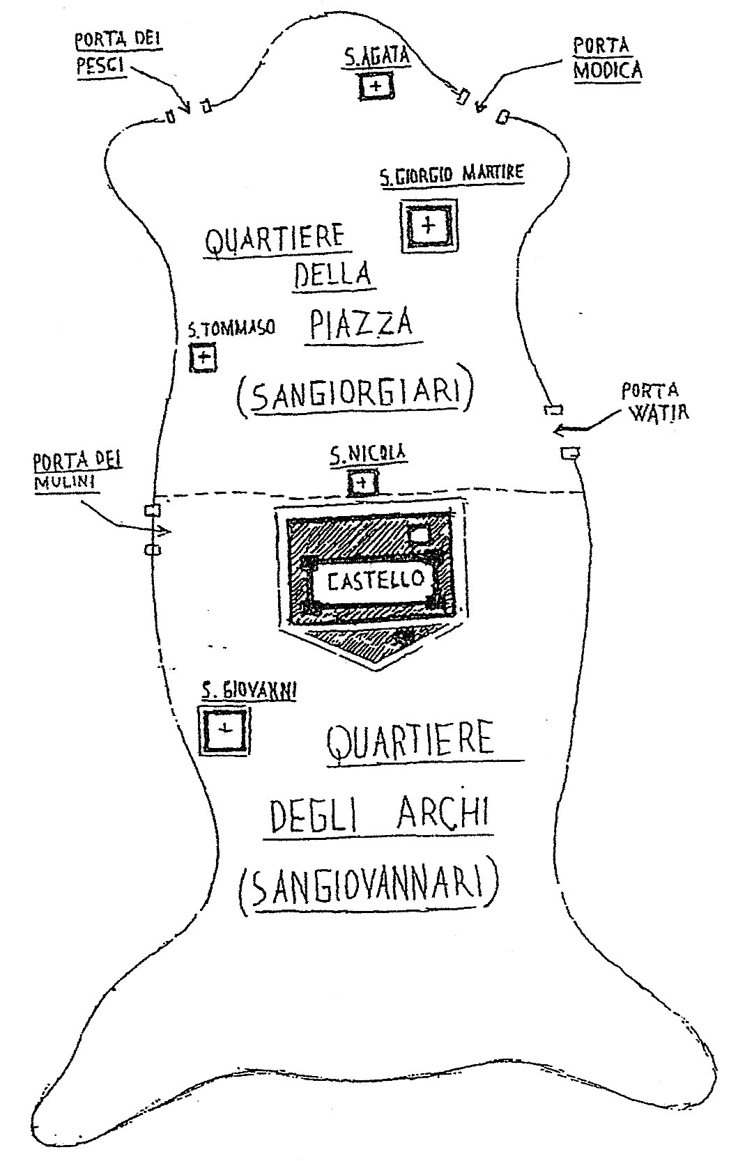
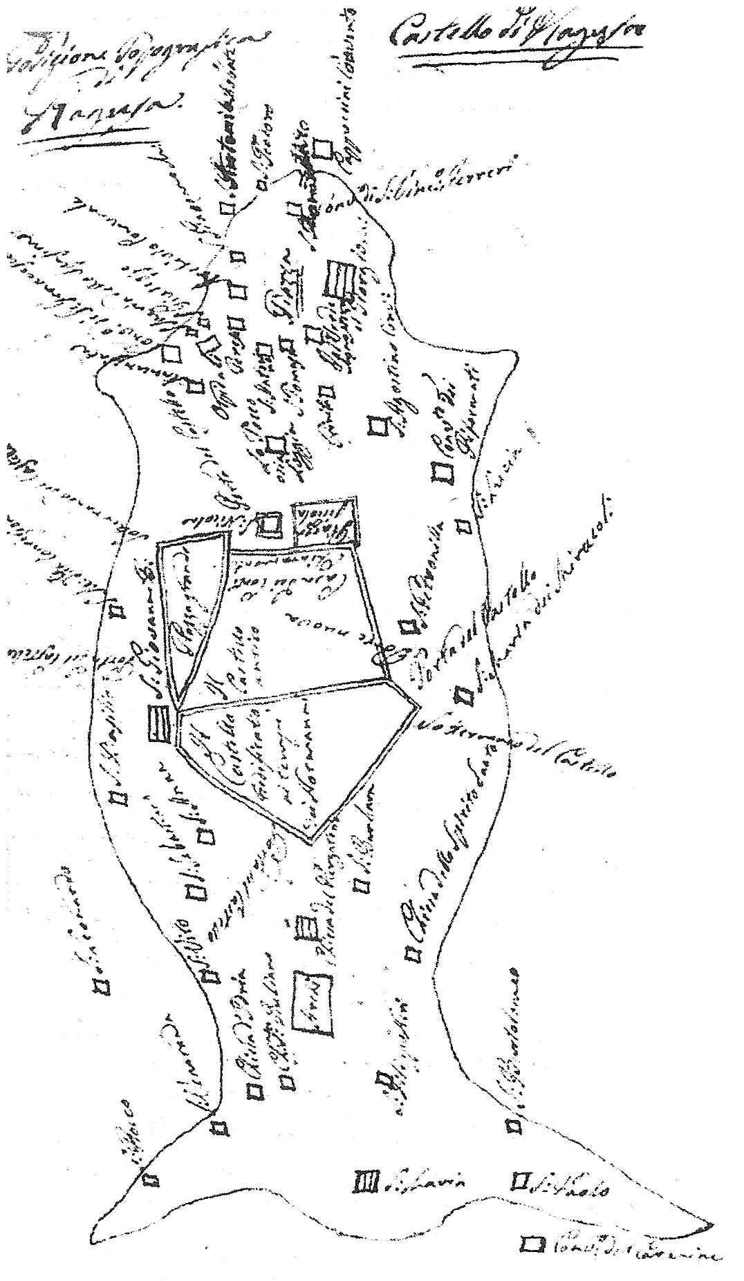
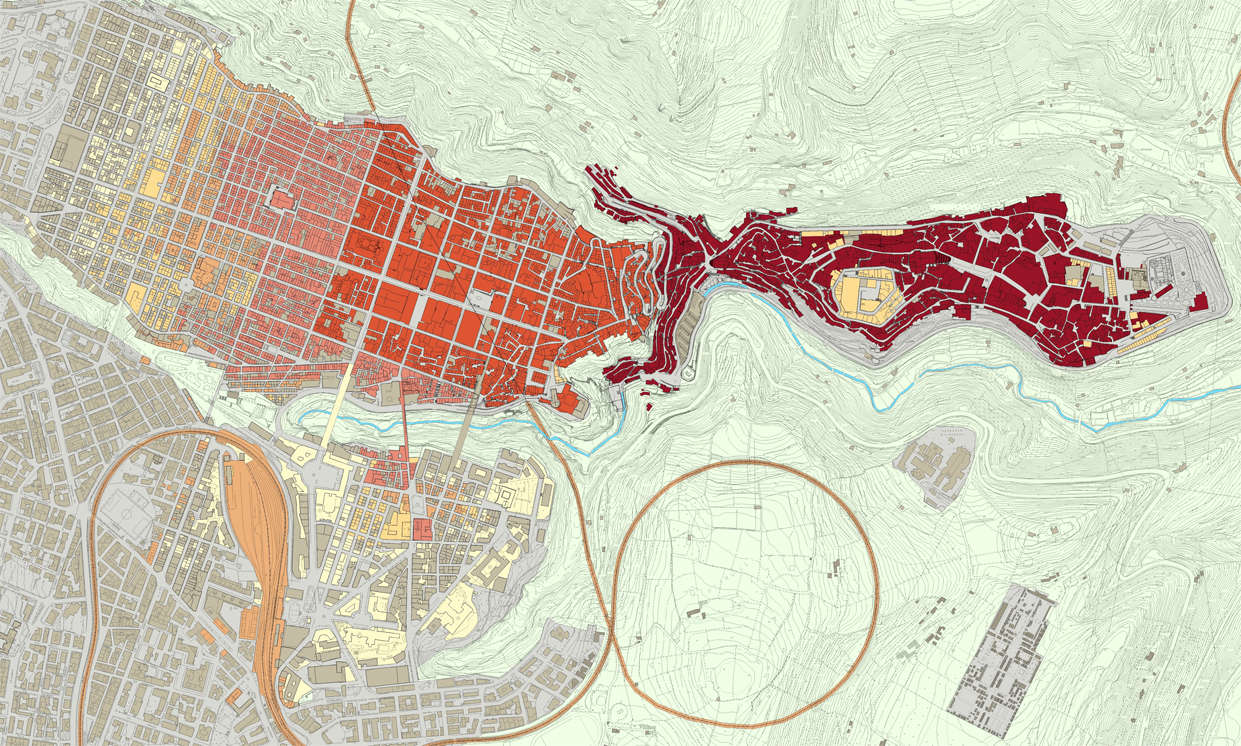
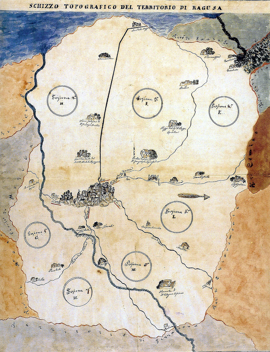
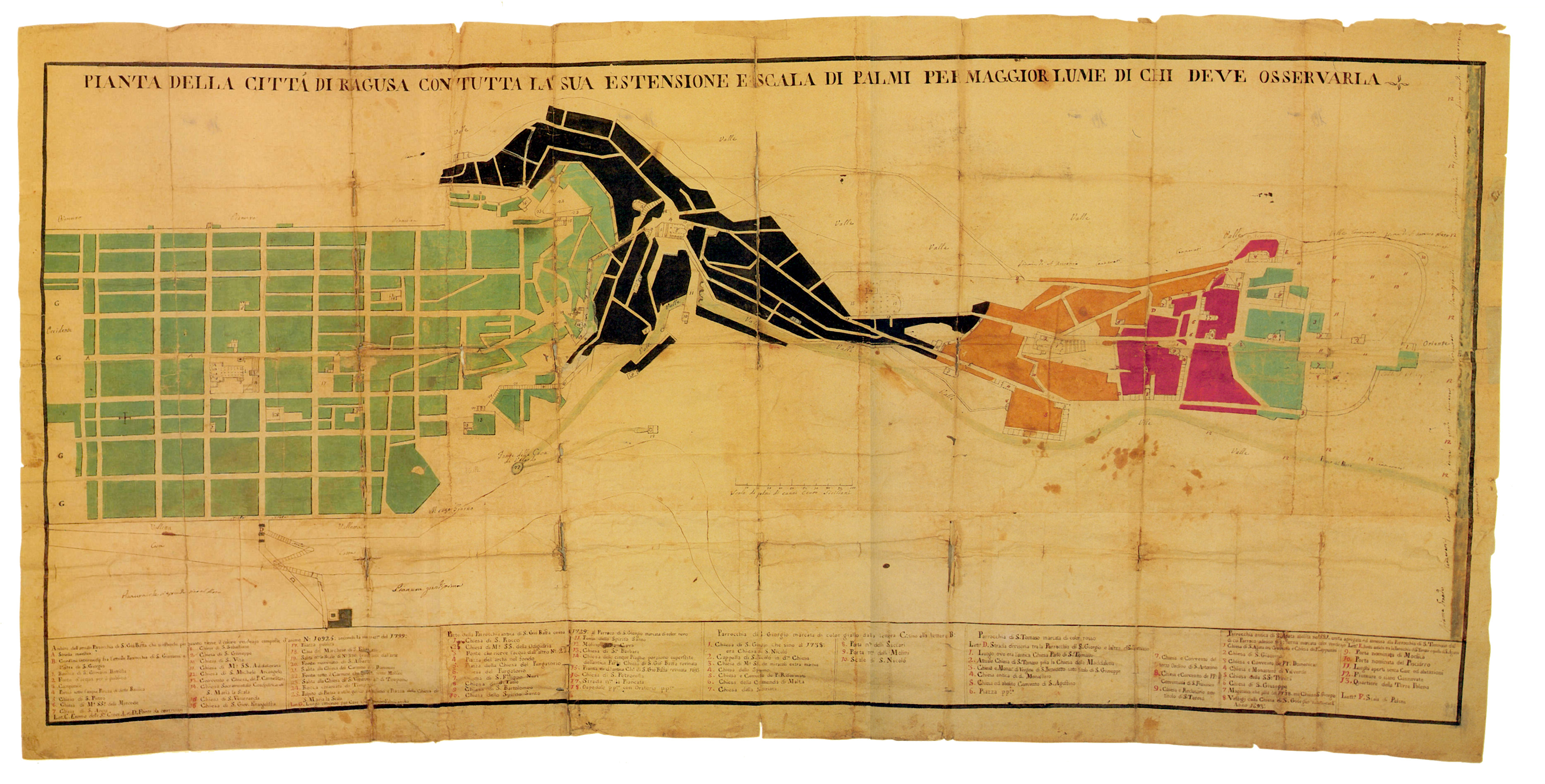
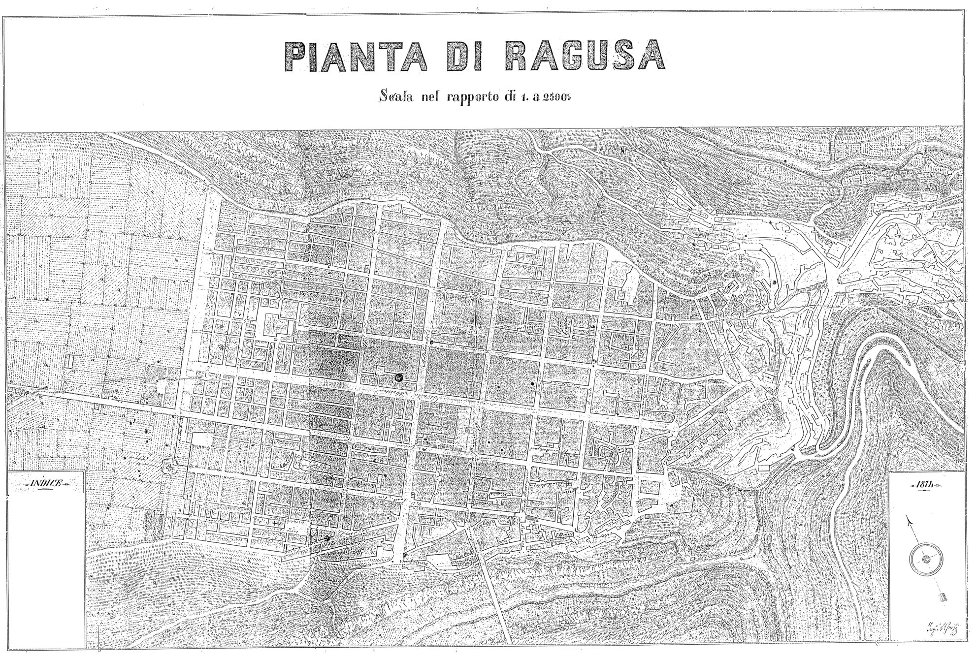
The city's origins are related to the different civilizations that have crossed Sicily over the centuries: Phoenicians, Sicilians, Greeks, Romans, Byzantines, Arabs, Normans, Spanish. Until the end of the seventeenth century the settlement was mainly concentrated on the eastern hill of Ibla, surrounded by single farms (“massariae”) and fields fenced with traditional stone walls. But the current urban structure and even the origins of its architectural image are connected to the reconstruction process started after the earthquake that in 1693 destroyed all the major towns in South-Eastern Sicily.
The quarrels for supremacy between the families belonging to the two antagonistic parishes of St. George and St. John, as well as the social conflicts existing between the feudal aristocracy and the new agricultural middle class, led the city to be rebuilt splitted in two parts. The nobles chose to rebuild their new city on the ruins of the old one, gradually raising on the medieval urban plan new Baroque architectures forming the peculiar architectural unity of Ragusa Ibla, which culminates in the new church of St. George. The emerging agricultural middle class (“massari”) chose instead to urbanize the “Patro” plateau, the highest hill west of Ibla, where they started to build a second independent core. The "new town" was planned according to an orthogonal grid. The “Mother Church”, dedicated to St. John the Baptist, was erected just in the centre.
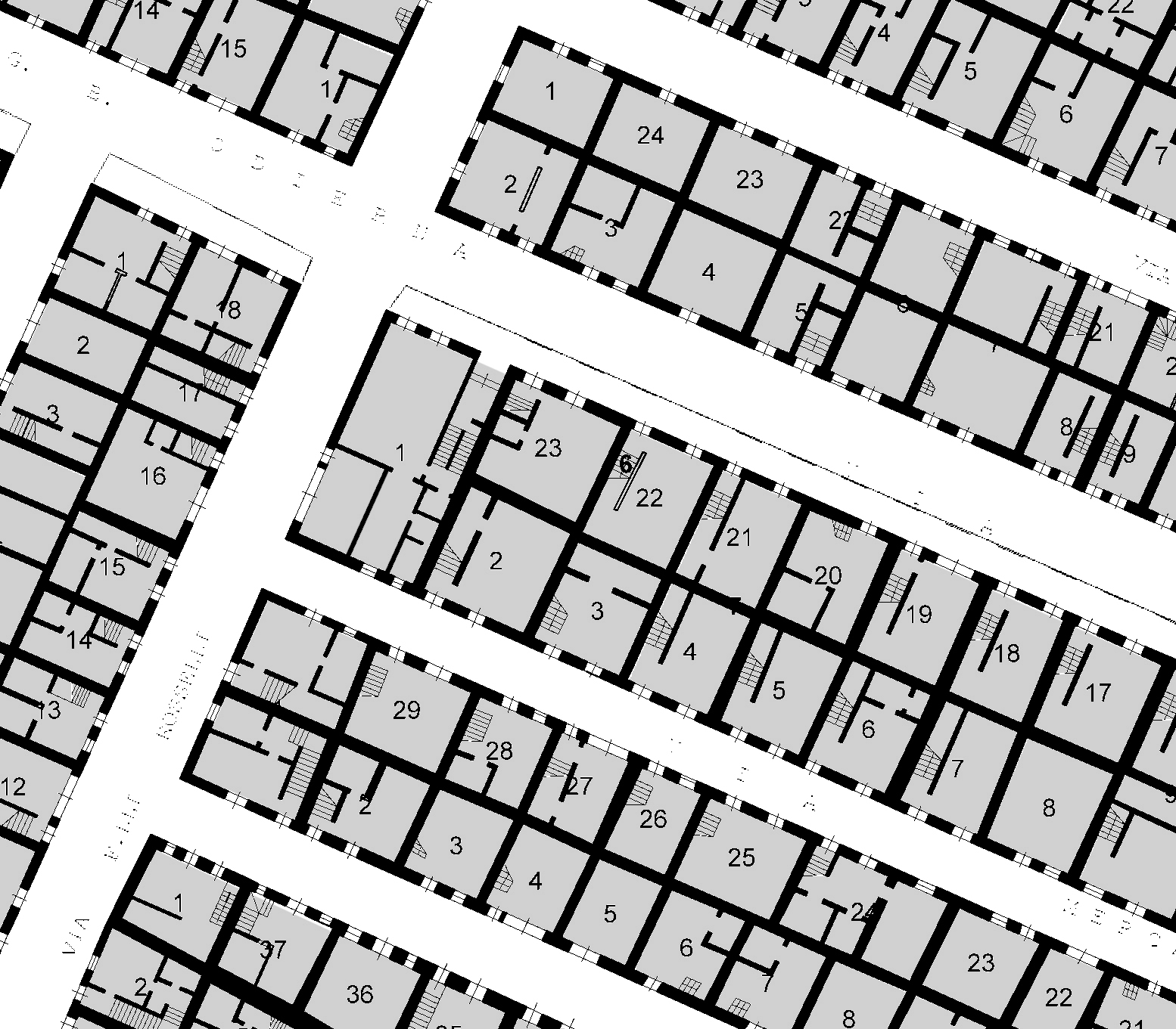
The building process of Ragusa Superiore proceeded from east to west through two and a half centuries. The fabric is made by two different parts with different types of blocks and buildings: the eastern sector is arranged according to an approximately 90x90 mt square grid; in its central area (among Via Roma, Via San Vito, Corso Italia and Via Vittorio Veneto) are inserted remarkable baroque palaces and monuments. Westward the grid is fragmented and subdued to a more intensive construction: small blocks are parceled into many lots, sometimes smaller than 20 square mt on which more recent and ordinary buildings are standing.
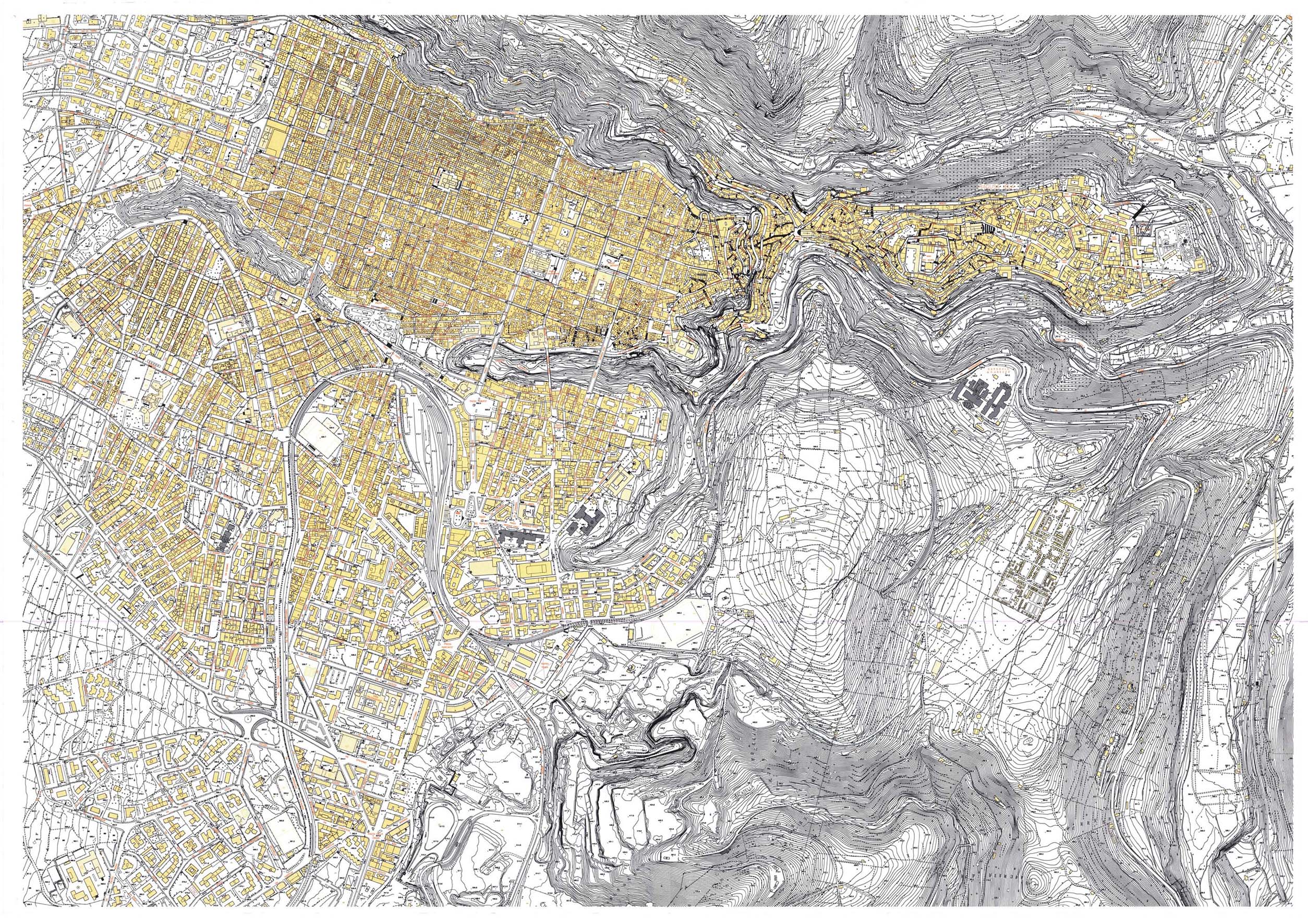
The dual slope of the ground, from west to east and from north to south, warps the final shape of the urban grid. On the borders of the plateau the fabric suddenly stops along the curved edges overlooking the two valleys that surround the hill: the deep San Leonardo valley to the north and Santa Domenica valley to the south. This one separates the historic center of Ragusa Superiore from its further extension southward, towards the railway station, whose development was increased after the construction of the Capuchins bridge at the end of the nineteenth century.
The undeniable lack of facilities, squares and public gardens within the city centre is the result of a gradual process of extensive densification and saturation. Two interesting masterplans tried to introduce inside the isomorphic scheme of the grid hierarchies and public spaces allocated in the different districts, but they have been ignored.
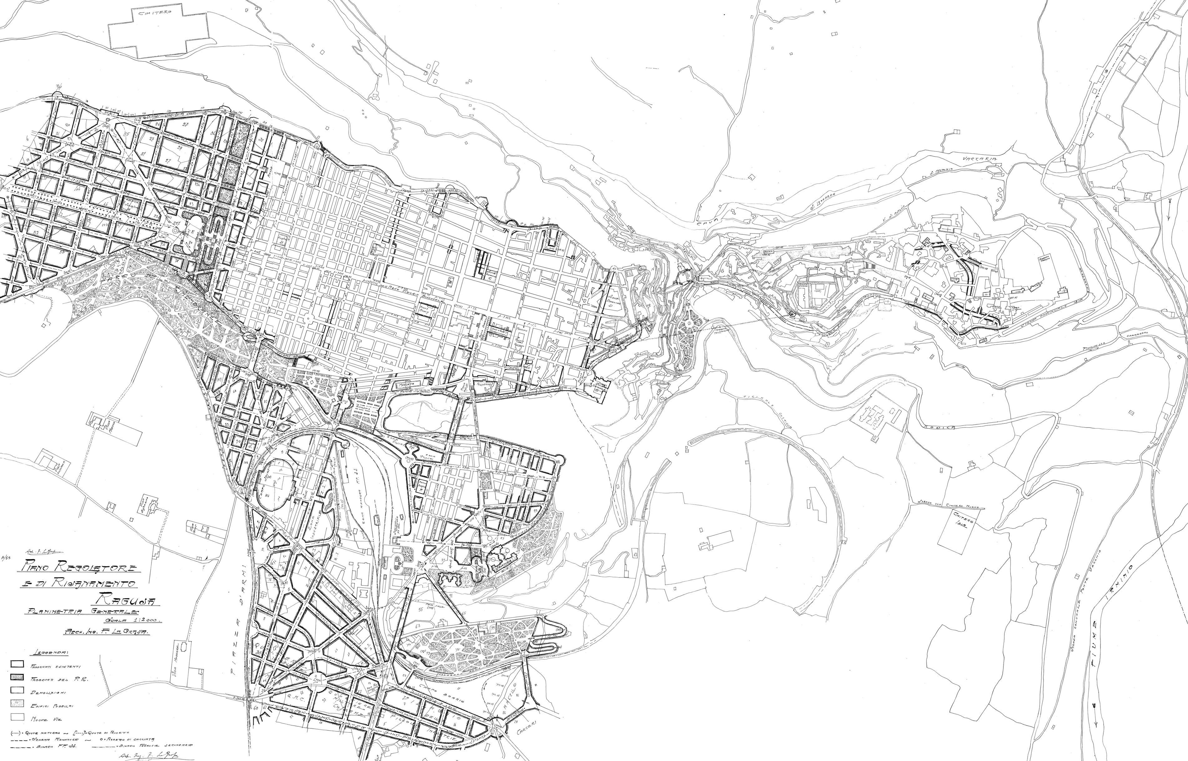
The first is the city plan drawn up by G. Migliorisi and approved in 1880, which provided for an adaptation of the grid to the needs of vehicular traffic, by widening some streets and integrating new facilities (market, theater) as well as squares (Casino and Serra neighborhoods) and public gardens (Borgo Cappuccini).
The second is the project drawn up by F. La Grassa and awarded at the competition for the new city plan in 1928. Here the “thinning” and street widening operations planned for the city centre were integrated within a general development of a new scale street network, supporting the natural extension of the city southward and westward.
In the Thirties, after the opening of the new bridge over Santa Domenica valley on the axis of Via Roma and the following implementation of a new square surrounded by public buildings (Piazza della Libertà), the southern district of the “New Ragusa” has been equipped with a new core located just midway between the historic centre and the railway station. The new square was designed by the rationalist architect Ernesto B. La Padula, well known as the designer of the Palace of Italian Civilization in Rome EUR district.
After the Second World War the historic centre of Ragusa Superiore went through a gradual saturation while on the borders of the valley massive public and private buildings have been built (as the seats of the Province and the Civil Engineering). In 1960 it was built the third bridge as an extension of San Vito Street.
The city plan approved in 1974 left the old town of Ragusa Superiore out from the restricted category of “historic centre”, so that several buildings have been torn down to be replaced with house very impacting multi-storey buildings, such as the INA insurance palace in front of St. John’s Cathedral, the Bank of Sicily, the new
Courthouse.
Since that moment a gradual depopulation of the old town led to a large decay of houses and commercial activities that used to form the socio-economic fabric of the centre. Symmetrically an extensive building activity has been quickly developed westward, giving rise to new housing districts with several apartment buildings and detached houses. Furthermore on the coast a lot of summer houses started to be built in “satellite” and seasonal town of the Marina di Ragusa thus leading to a new doubling of the city: Ragusa is currently the Italian city with the highest per capita real estate surface.
The more recent Masterplan of the City Centre, which was enacted to overcome the deregulation of the previous years, introduced nevertheless rigid constraints that inhibit the regeneration process wished by the citizens.
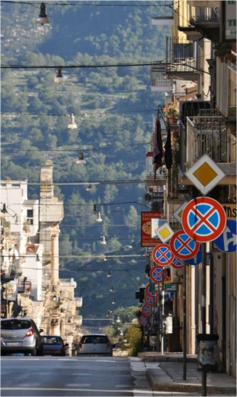
While today Ragusa Ibla regained vitality as a tourist and night life entertainment destination, Ragusa Superiore instead needs the launch of a new and extensive regeneration process that requires the set up of complex planning strategies and strong economic subsidies.
Download Brochure RE-USE Ragusa


